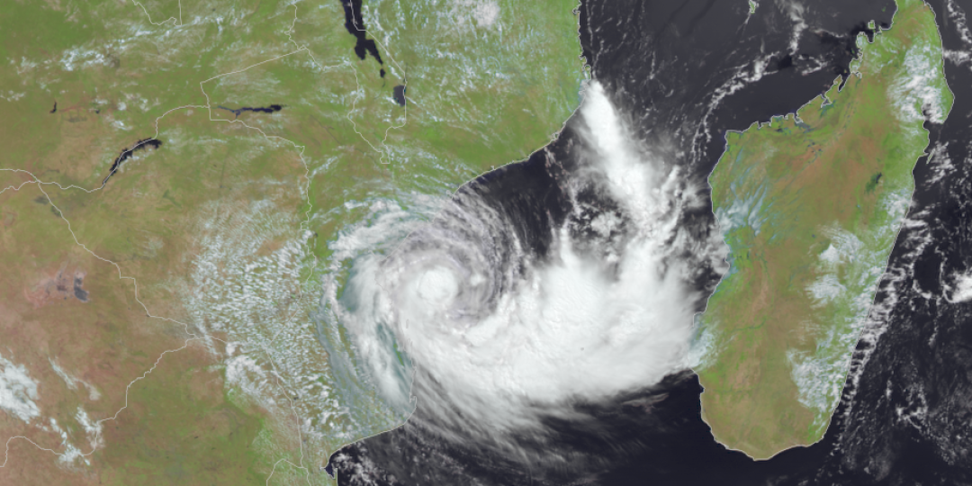
As predicted by the South African Weather Service (SAWS) yesterday, the weak, embryonic tropical low-pressure system located between Madagascar and mainland southern Africa (Mozambique Channel) experienced significant intensification overnight, attaining a ‘Moderate Tropical Storm’ status, which is associated with average winds of 63 to 89kph.
“Consequently, it has now been elevated to a ‘named’ system, namely Moderate Tropical Storm ‘Filipo’. The storm is expected to affect mostly the southern parts of Mozambique, but some of its effects will also be felt over the extreme north-eastern parts of South Africa,” the SAWS said in a press release.
A tropical low-pressure system can be defined as a less-dense air mass that is usually wetter and warmer than the surrounding air. Such a system can cause the formation of clouds and storms.
Recent modelling estimates by the Regional Specialised Meteorological Centre (RSMC) in La Réunion suggest that storm surge is likely to elevate local sea level by as much as 50cm (half a metre), especially along the coastline extending from Beira, southwards to Vilankulos.
The latest projected track for Filipo issued by RSMC La Réunion shows that, after making landfall last night (March 11), Filipo will rapidly follow a curved track, passing inland through southern Mozambique today (March 12), to exit near Xai Xai early tomorrow morning (March 13).
“For much of the southern Mozambican coastline, a high risk exists for weather-related damage from a combination of torrential rain, strong, damaging winds (with wind gusts well more than 100kph) as well as storm surge near the coastline,” the SAWS concluded.


